
Uithoorn
Uithoorn | |
|---|---|
 Church in Uithoorn | |
 Flag  Coat of arms | |
.svg) Location in North Holland | |
| Coordinates: 52°14′N 4°50′E / 52.233°N 4.833°E | |
| Country | Netherlands |
| Province | North Holland |
| Government | |
| • Body | Municipal council |
| • Mayor | Pieter Heiliegers (acting) (VVD) |
| Area | |
| • Total | 19.42 km2 (7.50 sq mi) |
| • Land | 18.14 km2 (7.00 sq mi) |
| • Water | 1.28 km2 (0.49 sq mi) |
| Elevation | −1 m (−3 ft) |
| Population (January 2021)[4] | |
| • Total | 30,206 |
| • Density | 1,665/km2 (4,310/sq mi) |
| Demonym | Uithoornaar |
| Time zone | UTC+1 (CET) |
| • Summer (DST) | UTC+2 (CEST) |
| Postcode | 1420–1424 |
| Area code | 0297 |
| Website | www |
Uithoorn (Dutch pronunciation: [œytˈɦoːr(ə)n] ⓘ) is a municipality and a town in the Netherlands, in the province of North Holland.
Population centres[edit]
The municipality of Uithoorn consists of the following cities, towns, villages and/or districts: De Kwakel and Uithoorn.

Dutch topographic map of the municipality of Uithoorn, June 2015
History[edit]
The name De Uithoorn (or also De Uythoorn) was used at the end of the Middle Ages for the location of the lower courts of the deanery of Saint John. The village formed around its courthouse.
People depended on agriculture and animal husbandry. Agriculture became increasingly more difficult due to the steady soil subsidence. From c. 1600 on, peat extraction became important and resulted in the formation of large ponds, which in turn would be made into polders later on.
During the Franco-Dutch War in the "disaster year" of 1672, Uithoorn was on the front lines and fortifications were built.
During the Batavian Republic period, the neighbouring village of Thamen was merged with Uithoorn. Its economy was limited but improved in the middle of the 19th century when some industries (including chemical) were established in the area. The reclamation of a few large ponds provided extra agricultural land at the end of the same century.
A sulphuric acid plant was established on the banks of the Amstel in 1863, it closed in the early 1900s; the site was subsequently (1922) used for a coal tar processor, Teerbedrijf Uithoorn, later known as Cindu Chemicals. A subsidiary company Nevcin Polymers also operated on the site: both companies were major employers in the town, and also polluters of the air and water bodies. In 1992 a reactor at the Nevcin site exploded, causing three deaths and several injuries. As of 2012 both plants remain in operation.
Circa 1885, several fortifications were built around Uithoorn as part of the Stelling van Amsterdam. In 1915 the railway was built through town.
After World War II, Uithoorn developed quickly: in 1948 the Thamerdal neighbourhood was built, followed by Zijdelwaard in 1960, Legmeer in 1972, Meerwijk-West and Meerwijk-Oost from 1985 on. In 1991 a new shopping centre was built in the town centre, at the expense of many original buildings.
Local government[edit]
The municipal council of Uithoorn consists of 23 seats, which are divided as follows:
- VVD - 4 seats
- DUS! (GroenLinks–D66) - 6 seats
- Gemeentebelangen - 8 seats
- CDA - 2 seats
- PvdA - 2 seats
- Groen Uithoorn - 1 seat
Notable people[edit]

- Maarten van 't Kruijs (1813-1885) a Dutch chess player and organist
- Johannes Voorhout (1647–1717) a Dutch Golden Age painter
- Piet Steenkamp (1925–2016) a Dutch politician
- Hans Koeleman (born 1957) a retired Dutch middle- and long-distance runner, competed in the steeplechase at the 1984 and 1988 Summer Olympics
- Ruud Koopmans (born 1961) is a Dutch sociologist and academic
- Angela Schijf (born 1979) a Dutch actress[5]
- Lars Veldwijk (born 1991) a Dutch-born South African professional footballer with over 200 club caps
Gallery[edit]
-
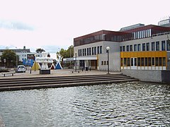 Uithoorn town hall
 -
 Station Uithoorn - panoramio
 -
 Uithoorn kunstwerk onbekend2 amstelplein
 -
 Fort aan de Drecht - panoramio


.jpg)
References[edit]
- ^ "Burgemeester D.H. (Dagmar) Oudshoorn-Tinga" [Mayor D.H. (Dagmar) Oudshoorn-Tinga] (in Dutch). Gemeente Uithoorn. Retrieved 22 March 2014.
- ^ "Kerncijfers wijken en buurten 2020" [Key figures for neighbourhoods 2020]. StatLine (in Dutch). CBS. 24 July 2020. Retrieved 19 September 2020.
- ^ "Postcodetool for 1423AJ". Actueel Hoogtebestand Nederland (in Dutch). Het Waterschapshuis. Retrieved 22 March 2014.
- ^ "Bevolkingsontwikkeling; regio per maand" [Population growth; regions per month]. CBS Statline (in Dutch). CBS. 1 January 2021. Retrieved 2 January 2022.
- ^ IMDb Database retrieved 26 January 2020
External links[edit]
 Media related to Uithoorn at Wikimedia Commons
- Official website
Places adjacent to Uithoorn | ||||||||||||||||
|---|---|---|---|---|---|---|---|---|---|---|---|---|---|---|---|---|
| ||||||||||||||||

| International | |
|---|---|
| National | |
| Geographic | |