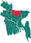
Phulpur Upazila
Phulpur
ফুলপুর | |
|---|---|
 Phulpur Degree College | |
 | |
| Coordinates: 24°58′23″N 90°20′56″E / 24.973°N 90.349°E | |
| Country | |
| Division | Mymensingh |
| District | Mymensingh |
| Headquarters | Phulpur |
| Area | |
| • Total | 312.53 km2 (120.67 sq mi) |
| Population (2011) | |
| • Total | 303,546 |
| • Density | 970/km2 (2,500/sq mi) |
| Time zone | UTC+6 (BST) |
| Website | Official Map of Phulpur |
Phulpur (Bengali: ফুলপুর) is an upazila of Mymensingh District[1] in the Division of Mymensingh, Bangladesh.
Demographics[edit]
2011 Bangladesh census, Phulpur has a population of 601,766 living in 153,361 households. Males constitute 49.48% of the population and females 50.52%. Muslims form 96.27% of the population, Hindus 3.46%, Christians 0.18%, and others 0.10%. Phulpur has a literacy rate of 37.66% for the population above age seven.[3]
According to the 2011 Bangladesh census, residual Phulpur Upazila had 87,523 households and a population of 303,546. 85,736 (28.24%) were under 10 years of age. Phulpur has a literacy rate (age 7 and over) of 38.04%, compared to the national average of 51.8%, and a sex ratio of 1024 females per 1000 males. 25,628 (8.44%) lived in urban areas. Muslims were 294,539 and Hindus 8,112.[2]
As of the 1991 Bangladesh census Phulpur had a population of 459,046, with males constituting 50.98% of the population and females 49.02%. This Upazila's 18+ population is 221,110. Phulpur had an average literacy rate of 72% (7+ years). compared to the national average of 32.4%.[4]
Administration[edit]
Phulpur Upazila is divided into Phulpur Municipality and ten union parishads: Balia, Baola, Payari, Phulpur, Rahimganj, Rambhadrapur, Rupasi, Singheshwar, Chhandhara, and Bhaitkandi.[5][6][7]
Phulpur Municipality is subdivided into 9 wards and 12 mahallas.[5]
See also[edit]
References[edit]
- ^ Nurul Amin (2012), "Phulpur Upazila", in Sirajul Islam and Ahmed A. Jamal (ed.), Banglapedia: National Encyclopedia of Bangladesh (Second ed.), Asiatic Society of Bangladesh
- ^ a b "Bangladesh Population and Housing Census 2011 Community Report – Mymensingh" (PDF). bbs.gov.bd. Bangladesh Bureau of Statistics.
- ^ "Bangladesh Population and Housing Census 2011: Zila Report – Mymensingh" (PDF). Table P01 : Household and Population by Sex and Residence, Table P05 : Population by Religion, Age group and Residence, Table P09 : Literacy of Population 7 Years & Above by Religion, Sex and Residence. Bangladesh Bureau of Statistics (BBS), Ministry of Planning, Government of the People’s Republic of Bangladesh. Retrieved 14 December 2018.
- ^ "Population Census Wing, BBS". Archived from the original on 2005-03-27. Retrieved November 10, 2006.
- ^ a b "District Statistics 2011: Mymensingh" (PDF). Bangladesh Bureau of Statistics. Archived from the original (PDF) on 13 November 2014. Retrieved 14 July 2014.
- ^ কর্মকর্তার অভাবে দুই মাসেও তারাকান্দায় কাজ শুরু হয়নি [Work in Tarakanda did not start for two months due to lack of officers]. Prothom Alo (in Bengali). 15 December 2013.
- ^ তারাকান্দা উপজেলা [List of Unions]. Tarakanda Upazila (in Bengali).

