
Peak to Peak Scenic Byway
Peak to Peak Scenic Byway National Forest Scenic Byway | |
|---|---|
| Route information | |
| Maintained by CDOT | |
| Length | 55 mi[1][2] (89 km) |
| Existed | 1989–present |
| Major junctions | |
| South end | |
| North end | |
| Location | |
| Country | United States |
| State | Colorado |
| Counties | Gilpin, Boulder, Larimer counties |
| Highway system | |
| |


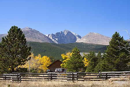
The Peak to Peak Scenic Byway is a 55-mile (89 km) National Forest Scenic Byway and Colorado Scenic and Historic Byway located in Gilpin, Boulder, Larimer counties, Colorado, USA. The Peak to Peak Highway was originally built in 1918[3] and provides views of the Front Range mountains in the Colorado Rocky Mountains. It was Colorado's first scenic highway. The Central City/Black Hawk Historic District is a National Historic Landmark.
The Peak to Peak Highway connects to the Trail Ridge Road/Beaver Meadow National Scenic Byway at Estes Park.
Route[edit]
Parks & Recreation Areas[edit]
- Rocky Mountain National Park
- Golden Gate Canyon State Park
- Arapaho National Forest
- Roosevelt National Forest
- Indian Peaks Wilderness
Mountain peaks[edit]
- Mount Flora
- Mount Eva
- Mount Epworth
- Mount Jasper
- Apache Peak
- Mount Audubon 13,229 feet (4,032 m)
- Meadow Mountain
- Copeland Mountain
- Mount Meeker 13,916 feet (4,242 m)
- Longs Peak 14,259 feet (4,346 m)
- Twin Sisters Peaks
Gallery[edit]
-
 Aspen Trees on the Peak to Peak
 -
-
 Chapel on the Rock (officially, Saint Catherine of Siena Chapel)
.jpg)


See also[edit]
Notes[edit]
References[edit]
- ^ "Peak to Peak". Colorado Department of Transportation. 2021. Retrieved April 8, 2022.
- ^ "Peak to Peak Scenic and Historic Byway". America's Scenic Byways. Retrieved April 8, 2022.
- ^ Colorado Department of Transportation. "Peak To Peak". Colorado Department of Transportation.
External links[edit]
Colorado at Wikipedia's sister projects
 Media from Commons
 News from Wikinews
 Quotations from Wikiquote
 Travel information from Wikivoyage
- America's Scenic Byways: Colorado
- Colorado Department of Transportation
- Colorado Tourism Office
- History Colorado
- National Forest Scenic Byways
Categories:
- Colorado Scenic and Historic Byways
- National Forest Scenic Byways
- National Forest Scenic Byways in Colorado
- Roosevelt National Forest
- Transportation in Colorado
- Transportation in Boulder County, Colorado
- Transportation in Gilpin County, Colorado
- Transportation in Larimer County, Colorado
- Tourist attractions in Colorado
- Tourist attractions in Boulder County, Colorado
- Tourist attractions in Gilpin County, Colorado
- Tourist attractions in Larimer County, Colorado
- U.S. Route 34
- U.S. Route 36