
Johnstown, New York
Johnstown | |
|---|---|
 Johnson Hall, home of Sir William Johnson, New York State Historic Site (2020) | |
| Nickname: + | |
 Johnstown Location within the state of New York | |
| Coordinates: 43°0′26″N 74°22′20″W / 43.00722°N 74.37222°W | |
| Country | United States |
| State | New York |
| County | Fulton |
| Settled | 1758 |
| Incorporated | 1803 (village) 1895 (city) |
| Founded by | Sir William Johnson |
| Government | |
| • Type | (Mayor-Council) |
| • Mayor | Amy Praught (R) |
| • Common Council | Members' List |
| Area | |
| • Total | 4.82 sq mi (12.50 km2) |
| • Land | 4.82 sq mi (12.49 km2) |
| • Water | 0.00 sq mi (0.01 km2) |
| Elevation | 673 ft (205 m) |
| Population (2020) | |
| • Total | 8,204 |
| • Density | 1,702.07/sq mi (657.11/km2) |
| Time zone | UTC-5 (Eastern (EST)) |
| • Summer (DST) | UTC-4 (EDT) |
| ZIP code | 12095 |
| Area code | 518 |
| FIPS code | 36-38781 |
| GNIS feature ID | 0954147 |
| Website | cityofjohnstown |
Johnstown is a city in and the county seat of Fulton County in the U.S. state of New York. The city was named after its founder, Sir William Johnson, Superintendent of Indian Affairs in the Province of New York and a major general during the Seven Years' War in North America.[2] It is located approximately 45 miles (72 km) northwest of Albany, about one-third of the way between Albany and the Finger Lakes region to the west, in the Mohawk Valley region, within the foothills of the Adirondack Mountains.
The city of Johnstown is mostly surrounded by the town of Johnstown, of which it was once a part when it was a village. Adjacent to Johnstown is the City of Gloversville. The two cities are together known as the "Glove Cities" due to their history of manufacturing gloves and other leather apparel. Gloversville and Johnstown together constituted the center of the American glove industry for 90 years until competition from other countries drove most of the manufacturers out of business.
As of the 2010 Census, the city had population of 8,743.[3]

History[edit]
Early colonial history[edit]
The Irishman William Johnson came to the Province of New York from Ireland in 1738.[4] Johnson was a trader who learned Native American languages and culture, and formed close relationships with many Native American leaders, especially those of the Mohawks and other members of the Iroquois Confederacy. His alliances and influence with the Iroquois played a significant part in the French and Indian War, in which he was a major general.
As a reward for his services, Johnson received large tracts of land in what are now Hamilton and Fulton counties. He established Johnstown and became one of New York's most prosperous and influential citizens. He was the largest landowner in the Mohawk Valley, with an estate of more than 400,000 acres (1,600 km2) before his death. Having begun as an Indian trader, he expanded his business interests to include a sawmill and lumber business, and a flour mill that served the area. Johnson, the largest slaveholder in the county and perhaps in the state of New York, had some 60 enslaved Africans working these businesses. He also recruited many Scottish Highlander and Irish tenant farmers to work his lands.[5] Observing Johnson's successful business endeavors, the local Native American inhabitants dubbed him Warragghivagey, or "he who does much business."[6]

Johnson founded the village of Johnstown – originally "John's Town" – in 1762, naming it after his son John Johnson.[7] Johnson built a school, which was free but not mandatory, to educate both Mohawk and white children. He was also instrumental in the organization of St. John's Espiscopal Church. Johnson, who had been living in what is now known as Old Fort Johnson, also built a large manor house and estate for himself in 1763, Johnson Hall, where he lived until his death. Johnson Hall was designated a National Historic Landmark in 1960. It is operated by New York State as an historic site.
As the area owned and settled by Johnson grew, he convinced the governor, William Tryon, to establish a new county in upstate New York west of Albany County. This new county was named Tryon, after the governor, and Johnstown was made the county seat.[4] The county courthouse, built by William Johnson in Johnstown in 1772, partly at his own expense, still stands today, as the oldest operating courthouse in New York.[8] Sir William Johnson died in 1774 before the American colonies declared their independence from Britain.
Revolutionary War and aftermath[edit]
After the onset of the American Revolutionary War, many British Loyalists, including Johnson's son John and his family fled both Johnstown and the surrounding area for Canada. All of the Johnson property was confiscated by the state in 1779 because of the family's Loyalist sentiments and support for the British cause. Johnson Hall suffered vandalism at the hands of Continental soldiers quartered there.[9] The house and estate were subsequently sold to Silas Talbot, a naval officer and hero of the American Revolution.
Although the majority of the fighting during the Revolution took place elsewhere, Johnstown did see some fighting late in the war. With area residents not knowing of Cornwallis' defeat and surrender at the Battle of Yorktown in Virginia, about 1,400 soldiers fought at the Battle of Johnstown, one of the last battles of the Revolution, on October 25, 1781. The Continental forces, led by Col. Marinus Willett of Fort Johnstown, ultimately put the British to flight after they had burned large tracts of land in the Mohawk Valley.[10]
After the war, Johnstown became part of Montgomery County when the name of Tryon County was changed to honor the Continental General Richard Montgomery, who died at the Battle of Quebec.
19th century to the present[edit]
In 1803, the community of Johnstown was incorporated as a village. In 1838, Johnstown's county affiliation changed yet again when what by then remained of Montgomery County was divided into two separate counties: Montgomery and Fulton. While the village of Fonda became the new county seat of Montgomery County, Johnstown became the county seat of Fulton County. The village of Johnstown became a city in 1895, becoming separate from the surrounding town.
Elizabeth Cady Stanton, who became a prominent activist for women's rights, was born in Johnstown in 1815, and was educated at the Johnstown Academy.
In 1889, Johnstown suffered a devastating flood. The Cayadutta Creek rampaged, Schreiber's Skin Mill was swept away, as was the State Street bridge, and over twenty people were drowned or missing when the flood carried away the Perry Street bridge.
In 1906, the state of New York bought Johnson Hall from its private owners in order to renovate and preserve it.
Industrialization[edit]
With plentiful forests of hemlock trees and the wood bark they produced, Johnstown became a center for tanning of leather during the late 19th century. By the early 20th century Johnstown, along with neighboring Gloversville, became known as the glove-making capital of the world. Nicknamed the "Glove Cities", the two cities are still called that today.[11] Many fringe business once existed to support the glove and leather industries around Johnstown. Box manufacturers, thread dealers, sewing machine repairmen, chemical companies and many others made a living helping to supply and service the industry.[11]
One of the early industries to establish itself in Johnstown was the Knox gelatine plant. It was built in 1890 by Charles B. Knox, a prominent Johnstown resident, who developed the granulated, unflavored gelatin still used in food preparation today.[12][13] When Knox died in 1908, his wife Rose Knox assumed management of the business. She became one of the earliest successful American businesswomen. The Knox family and its philanthropic foundation were generous to the city. Results of their philanthropy can still be found there today. They gave the city the block of land known as Knox Field, where the playgrounds, athletic fields, and bridle path are located. Knox Junior High School was named in honor of the family. The Knox Gelatin plant, once a major employer in Johnstown, closed in 1975 following the sale of the company to the Lipton Tea Company.[14]
Geography[edit]
Johnstown is located along the southern edge of Fulton County, in the picturesque Mohawk Valley of upstate New York. It is slightly north of the route developed for the Erie Canal through what is now Montgomery County. Although not a hilltown, Johnstown is close to the Adirondack Mountains that stretch across the northern portion of Fulton County. It is situated near the southern border of the Adirondack Park.
According to the United States Census Bureau, the city has a total area of 4.88 square miles (12.65 km2), of which 4.88 square miles (12.63 km2) is land and 0.01 square miles (0.02 km2), or 0.17%, is water.[3] The city is bordered to the north, east, and west by the town of Johnstown, to the northeast by the city of Gloversville, and to the south by the town of Mohawk in Montgomery County.
Cayadutta Creek, which runs through the city, provided water power needed to generate the electricity required by the various industries that grew up in Johnstown.[15] The creek flows south to join the Mohawk River at Fonda.
East-west highways, New York State Route 29 and New York State Route 67, intersect in the city and also cross the north-south highway New York State Route 30A. NY 29 leads east 32 miles (51 km) to Saratoga Springs and northwest 8 miles (13 km) to Rockwood. NY 67 leads southeast 11 miles (18 km) to Amsterdam and west 18 miles (29 km) to St. Johnsville. NY 30A leads northeast 4 miles (6 km) to Gloversville and 10 miles (16 km) to Mayfield, as well as south 4.5 miles (7.2 km) to Fonda and 6 miles (10 km) to the New York Thruway.
Demographics[edit]
| Census | Pop. | Note | %± |
|---|---|---|---|
| 1870 | 3,282 | — | |
| 1880 | 5,013 | 52.7% | |
| 1890 | 7,768 | 55.0% | |
| 1900 | 10,130 | 30.4% | |
| 1910 | 10,447 | 3.1% | |
| 1920 | 10,908 | 4.4% | |
| 1930 | 10,801 | −1.0% | |
| 1940 | 10,666 | −1.2% | |
| 1950 | 10,923 | 2.4% | |
| 1960 | 10,390 | −4.9% | |
| 1970 | 10,045 | −3.3% | |
| 1980 | 9,360 | −6.8% | |
| 1990 | 9,058 | −3.2% | |
| 2000 | 8,511 | −6.0% | |
| 2010 | 8,743 | 2.7% | |
| 2020 | 8,204 | −6.2% | |
| U.S. Decennial Census[16] | |||
As of the census[17] of 2000, there were 8,511 people, 3,579 households, 2,208 families residing in the city. The population density was 1,751.1 inhabitants per square mile (676.1/km2). There were 3,979 housing units at an average density of 818.7 per square mile (316.1/km2). The racial makeup of the city was 96.6% White, 0.6% Black or African American, 0.3% Native American, 1.0% Asian, <0.1% Pacific Islander, 0.4% from other races, and 1.1% from two or more races. Hispanic or Latino of any race were 1.1% of the population.
There were 3,579 households, out of which 29.5% had children under the age of 18 living with them, 44.1% were married couples living together, 13.5% had a female householder with no husband present, and 38.3% were non-families. 33.3% of all households were made up of individuals, and 16.6% had someone living alone who was 65 years of age or older. The average household size was 2.30 and the average family size was 2.91.
In the city, the population was spread out, with 24.4% under the age of 18, 7.2% from 18 to 24, 27.6% from 25 to 44, 21.6% from 45 to 64, and 19.2% who were 65 years of age or older. The median age was 39 years. For every 100 females, there were 87.8 males. For every 100 females age 18 and over, there were 82.8 males.
The median income for a household in the city was $32,603, and the median income for a family was $39,909. Males had a median income of $30,636 versus $22,272 for females. The per capita income for the city was $17,324. About 9.3% of families and 13.2% of the population were below the poverty line, including 19.5% of those under age 18 and 8.2% of those age 65 or over.
Notable people[edit]
Silas Talbot[edit]
Silas Talbot moved with his family to Johnstown, where he purchased Sir William Johnson's estate and manor house. A hero of the American Revolution, he later served as a member of the New York Assembly (1792–1793) and as a congressman in the U.S. House of Representatives (1793–1794) from that district.
In 1797 he supervised the building of the USS Constitution ("Old Iron Sides") at the Charlestown Navy Yard in Boston, Massachusetts.[18] Talbot commanded the USS Constitution, largely in the West Indies, from 1799 to 1801, when he retired from the U.S. Navy.[19]
Daniel Cady[edit]
One of the men instrumental in shaping Fulton County was Judge Daniel Cady, a prominent Johnstown resident. Sometimes called "the father of Fulton County", Cady named the new county after Robert Fulton, who was related by marriage to Cady's wife, Margaret Livingston. Robert Fulton, an inventor, is perhaps best known for devising the improvements that made steamboats commercially viable.[20]
Judge Daniel Cady was one of Johnstown's most important citizens. With indirect connections by marriage to John Jacob Astor and that family's lucrative fur business interests, Daniel Cady, adept at managing these connections and his own business interests, joined the ranks of the wealthiest landowners in New York. After moving to Johnstown in 1799, he married Margaret Livingston, whose father, Col. James Livingston, fought in the Continental Army at the battles of Quebec and Saratoga during the American Revolution. Col. Livingston is credited with frustrating Benedict Arnold's attempted treason by firing on The Vulture, the boat intended to carry Arnold to safety.[21] A public servant as well as astute lawyer and businessman, Judge Cady served in the New York state legislature from 1808 until 1814. In 1814 he was elected as a Federalist to one term in the United States House of Representatives. In 1816, he returned to Johnstown from Washington and resumed his legal practice. He later served as a judge on the New York Supreme Court, Fourth District, from 1847 until 1855. Cady died in Johnstown in 1859 and is buried in the cemetery there.[22]
John D. McDonald[edit]
John D. McDonald (1816–1900) was born in Johnstown. Orphaned at 12, he took off for the Wisconsin Territory at age 20, where he was a farmer (lived on the same farm for 63 years) and served in the Wisconsin State Assembly and in various local office.[23]
Israel T. Hatch[edit]
Hatch was born in Johnstown. He went on to become mayor of Buffalo, New York, and was also elected to the U.S. House of Representatives. He was law partners with Henry K. Smith, who also became a mayor of Buffalo.
Elizabeth Cady Stanton[edit]
Daniel Cady is today perhaps best known as the father of the prominent women's rights activist Elizabeth Cady Stanton, who was born in Johnstown in 1815. Stanton, who later worked in partnership with Susan B. Anthony and served for many years as president of the National Woman Suffrage Association (NWSA), spent her childhood in Johnstown, where she studied at the Johnstown Academy. It was one of the first schools in New York to receive a teaching certificate issued by the newly formed state education system in the later 19th century.[11] After leaving to continue her education in Troy, New York, Stanton returned to Johnstown with her husband Henry Brewster Stanton, a lawyer and abolitionist who studied law under her father, Daniel Cady.[24] Because of her role, Johnstown, together with Seneca Falls, New York, where Elizabeth Cady Stanton helped organize the first Women's Rights Convention held in 1848, lays claim to being the birthplace of the women's rights movement in the United States.[25] Stanton's speech, the Declaration of Sentiments, given at the Seneca Falls convention and modeled on the Declaration of Independence, is generally credited with instigating the women's suffrage movement in the United States.
George Linius Streeter[edit]
George Linius Streeter was a noted embryologist and Director of the Carnegie Institution of Washington. Son of George Austin Streeter, a glove-maker.
Gallery[edit]
-
 The Drumm House is one of six cottages built by Sir William Johnson c.1763 to house the tenant farmers he brought to the New World to become soldiers
 -
 Union Hall, a well-known tavern on the post-Revolutionary War period, was built in 1798
 -
 Built in 1798 as Johnstown Academy, this building was converted into a glove-making factory in 1886.
 -
 The Knox Mansion was built in 1889 by Knox gelatin magnate Charles Knox It is listed on the National Register of Historic Places (NRHP)
 -
 A block of West Main Street in downtown Johnstown


-
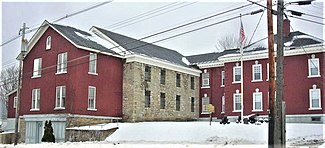 The Fulton County Jail, built in 1773 and expanded c.1806, became Fort Johnstown and was the headquarters of American militiamen who fought in the Battle of Johnstown in the American Revolutionary War. (NRHP)
 -
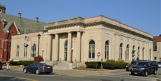 The U.S. Post Office in Johnstown was built in 1913 (NRHP)


References[edit]
Notes
- ^ "ArcGIS REST Services Directory". United States Census Bureau. Retrieved September 20, 2022.
- ^ Gannett, Henry (1905). The Origin of Certain Place Names in the United States. Govt. Print. Off. pp. 170.
- ^ a b "Geographic Identifiers: 2010 Census Summary File 1 (G001), Johnstown city, New York". American FactFinder. U.S. Census Bureau. Archived from the original on February 13, 2020. Retrieved June 17, 2016.
- ^ a b Decker, p.7
- ^ Williams-Myers, p. 24; 29–30
- ^ Decker, p. 29
- ^ Decker, back cover
- ^ Decker, p. 8
- ^ Decker pp. 32–33, 116
- ^ "Dateline: September 22, 1996 – Johnstown streets, fields erupt in furious battle Sunday". johnstown.com. Archived from the original on December 6, 2006.
- ^ a b c Decker
- ^ "Charles B Knox Gelatine Co. Inc. Edition of The Old Mohawk-Turnpike Book". Retrieved June 9, 2016.
- ^ "Knox® History". Retrieved June 9, 2016.
More than one hundred years since the brand was first introduced, Knox® Unflavoured Gelatine is still as timely as ever.
- ^ Decker, pp. 53–66
- ^ Decker, p. 66
- ^ "Census of Population and Housing". Census.gov. Retrieved June 4, 2015.
- ^ "U.S. Census website". United States Census Bureau. Retrieved January 31, 2008.
- ^ Mystic Seaport Library (Silas Talbot) Archived 2003-05-06 at the Wayback Machine; Decker p. 31
- ^ "Mystic Seaport Library (Silas Talbot)". Archived from the original on May 6, 2003. Retrieved September 19, 2006.
- ^ Decker, p. 33
- ^ Griffith, p. 4
- ^ Griffith, p. 5
- ^ Wisconsin Blue Book 1871, "Biographical Sketch of John D. McDonald", p. 386
- ^ Griffith
- ^ Decker, pp. 16, 33
Bibliography
- Decker, Lewis G. Images of America: Johnstown. Arcadia Publishing (an imprint of Tempus Publishing, Inc.); Charleston, SC. 1999. ISBN 0738501743.
- Griffith, Elizabeth. In Her Own Right: The Life of Elizabeth Cady Stanton. Oxford University Press; New York. 1984. ISBN 0195037294.
- Historic Johnstown, New York, accessed September 19, 2006.
- Mystic Seaport Library; Manuscripts Collection (Silas Talbot) accessed September 19, 2006.
- Williams-Myers, A.J. Long Hammering: Essays on the Forging of an African American Presence in the Hudson River Valley to the Early Twentieth Century. Africa World Press, Inc.; Trenton, NJ. 1994. ISBN 0865433038.
- "Vern Jackson elected city of Johnstown mayor"
External links[edit]
Municipalities and communities of Fulton County, New York, United States | ||
|---|---|---|
| Cities | 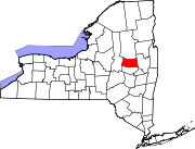 | |
| Towns | ||
| Villages | ||
| CDP | ||
| Other Hamlets | ||
| Footnotes | ‡This populated place also has portions in an adjacent county or counties | |

Albany (capital) | |
| Topics | |
| Politics | |
| Regions |
|
| Metro areas | |
| Counties |
|
| Places | |
| History | |
| International | |
|---|---|
| National | |