
Grantville Historic District
Grantville Historic District | |
 | |
 | |
| Location | Bounded by US 29, LaGrange St., W. Grantville Rd. and the city cemetery, Grantville, Georgia |
|---|---|
| Coordinates | 33°14′07″N 84°50′05″W / 33.23528°N 84.83472°W |
| Area | 192 acres (0.78 km2) |
| Built | 1852 |
| Built by | Atlanta & LaGrange Railroad |
| Architectural style | Mid 19th Century Revival, Late 19th and 20th Century Revivals, Late Victorian |
| NRHP reference No. | 91000772[1] |
| Added to NRHP | June 14, 1991 |
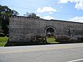
The Grantville Historic District, in Grantville, Georgia, is a historic district which was listed on the National Register of Historic Places in 1991. The listing included 225 contributing buildings, a contributing structure, and a contributing site on 192 acres (0.78 km2).[1]
The district is bounded by U.S. Route 29, LaGrange St., W. Grantville Rd. and the city cemetery.[2]
It includes railroad tracks through the center of the district, with commercial buildings on both sides, mostly brick buildings. It includes residential areas and two historic mill complexes with mill villages. It also includes a school, a waterworks, an auditorium, several churches and, on the eastern edge of the district, the city cemetery.[2]
Gallery[edit]
-
 Griffin Street Buildings - August 2014
 -
 Abandoned Building - August 2014
 -
 Bonnie Castle - August 2014
 -
 Banks and Arnold Store - August 2014
 -
 Passenger Depot - August 2014
 -
 Jefferson Davis Highway Marker - August 2014


References[edit]
- ^ a b "National Register Information System". National Register of Historic Places. National Park Service. November 2, 2013.
- ^ a b Lisa Raflo (April 29, 1991). "National Register of Historic Places Registration: Grantville Historic District". National Park Service. Retrieved December 14, 2019. With accompanying 41 photos from 1990
| Topics | |
|---|---|
| Lists by state |
|
| Lists by insular areas | |
| Lists by associated state | |
| Other areas | |
| Related | |
Categories:
- Historic districts on the National Register of Historic Places in Georgia (U.S. state)
- National Register of Historic Places in Coweta County, Georgia
- Georgian architecture in Georgia (U.S. state)
- Victorian architecture in Georgia (U.S. state)
- Buildings and structures completed in 1852
- Georgia (U.S. state) Registered Historic Place stubs