
File:Townhouse Row Cburg.JPG

Size of this preview: 800 × 480 pixels. Other resolutions: 320 × 192 pixels | 1,024 × 614 pixels | 1,280 × 767 pixels | 2,354 × 1,411 pixels.
Original file (2,354 × 1,411 pixels, file size: 1.11 MB, MIME type: image/jpeg)
| This is a file from the Wikimedia Commons. Information from its description page there is shown below. Commons is a freely licensed media file repository. You can help. |
|
This is an image of a place or building that is listed on the National Register of Historic Places in the United States of America. Its reference number is 78002401. |
Summary
| Description |
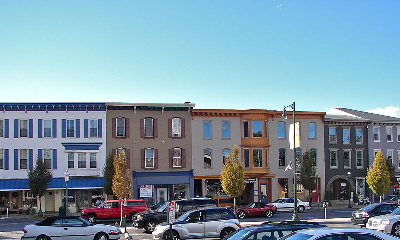
English: Townhouse Row on the NRHP since December 18, 1978. At 57–85 North Main Street, Chambersburg, Pennsylvania. Just north of the Diamond (central square), most of these buildings were probably built right after the US Civil War, when the Confederates burnt the town down. |
| Date | |
| Source | Own work |
| Author | Smallbones |
| Camera location | | View this and other nearby images on: OpenStreetMap |
|---|
Licensing
| I, the copyright holder of this work, release this work into the public domain. This applies worldwide. In some countries this may not be legally possible; if so: I grant anyone the right to use this work for any purpose, without any conditions, unless such conditions are required by law. |
File history
Click on a date/time to view the file as it appeared at that time.
| Date/Time | Thumbnail | Dimensions | User | Comment | |
|---|---|---|---|---|---|
| current | 12:48, 22 October 2010 | | 2,354 × 1,411 (1.11 MB) | Smallbones | {{Information |Description={{en|1=Townhouse Row on the NRHP since December 18, 1978. At 57–85 North Main Street, Chambersburg, Pennsylvania. Just north of the Diamond (central square), most of these buildings were probably built right after the US Civil |
File usage
The following pages on the English Wikipedia use this file (pages on other projects are not listed):
Global file usage
The following other wikis use this file:
- Usage on www.wikidata.org