
File:Rhodos topo.png
Size of this preview: 601 × 599 pixels. Other resolutions: 241 × 240 pixels | 481 × 480 pixels | 770 × 768 pixels | 1,027 × 1,024 pixels | 1,500 × 1,496 pixels.
Original file (1,500 × 1,496 pixels, file size: 1 MB, MIME type: image/png)
| This is a file from the Wikimedia Commons. Information from its description page there is shown below. Commons is a freely licensed media file repository. You can help. |
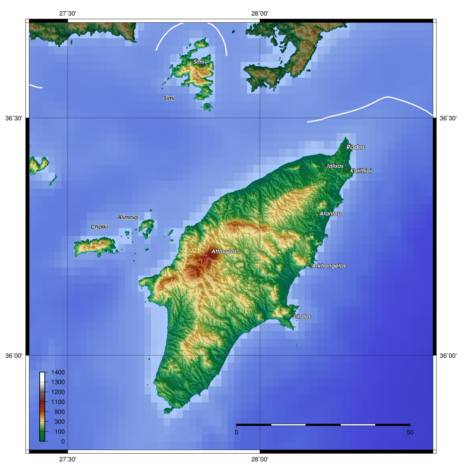
| Description | Description: Topography of Rhodes, created with GMT 4.1.3 | ||||||||||
| Date | |||||||||||
| Source |
At least one of the following Public Domain data sources |
||||||||||
| Author | Zamonin | ||||||||||
| Permission (Reusing this file) |
|

| Annotations | This image is annotated: View the annotations at Commons |
File history
Click on a date/time to view the file as it appeared at that time.
| Date/Time | Thumbnail | Dimensions | User | Comment | |
|---|---|---|---|---|---|
| current | 13:23, 20 November 2012 | | 1,500 × 1,496 (1 MB) | Zamonin | new labels |
| 07:29, 8 May 2009 |  | 1,500 × 1,394 (1.03 MB) | Zamonin | added cities, mountains; used etopo1 instead of etopo2 | |
| 12:06, 12 July 2006 |  | 969 × 975 (838 KB) | Zamonin | == Description, Source == * Description: Topography of Rhodos, created with [http://gmt.soest.hawaii.edu/ GMT] 4.1.3 * Source: At least one of the following Public Domain data sources ** [http://http://dss.ucar.edu/datasets/ds759.3/ ETOPO2] (Resolution 2 |
File usage
The following pages on the English Wikipedia use this file (pages on other projects are not listed):
Global file usage
The following other wikis use this file:
- Usage on af.wikipedia.org
- Usage on ar.wikipedia.org
- Usage on bg.wikipedia.org
- Usage on br.wikipedia.org
- Usage on ca.wikipedia.org
- Usage on cs.wikipedia.org
- Usage on cv.wikipedia.org
- Usage on de.wikipedia.org
- Usage on el.wikipedia.org
- Usage on es.wikipedia.org
- Usage on et.wikipedia.org
- Usage on fi.wikipedia.org
- Usage on fo.wikipedia.org
- Usage on fr.wikipedia.org
- Usage on gl.wikipedia.org
- Usage on hr.wikipedia.org
- Usage on hu.wikipedia.org
- Usage on hy.wikipedia.org
- Usage on incubator.wikimedia.org
- Usage on is.wikipedia.org
- Usage on it.wikipedia.org
- Usage on ja.wikipedia.org
- Usage on ka.wikipedia.org
- Usage on la.wiktionary.org
- Usage on lb.wikipedia.org
- Usage on lt.wikipedia.org
- Usage on mk.wikipedia.org
- Usage on nl.wikipedia.org
- Usage on nn.wikipedia.org
- Usage on no.wikipedia.org
- Usage on pl.wikipedia.org
- Usage on ru.wikipedia.org
- Usage on sk.wikipedia.org
- Usage on sr.wikipedia.org
- Usage on sv.wikipedia.org
- Usage on ta.wikipedia.org
- Usage on tr.wikipedia.org
- Usage on tt.wikipedia.org
- Usage on uk.wikipedia.org
View more global usage of this file.