
File:Kokuritsu Yoyogi Kyōgijō 1.jpg
Original file (4,412 × 2,941 pixels, file size: 8.81 MB, MIME type: image/jpeg)
| This is a file from the Wikimedia Commons. Information from its description page there is shown below. Commons is a freely licensed media file repository. You can help. |
Summary
| Description |
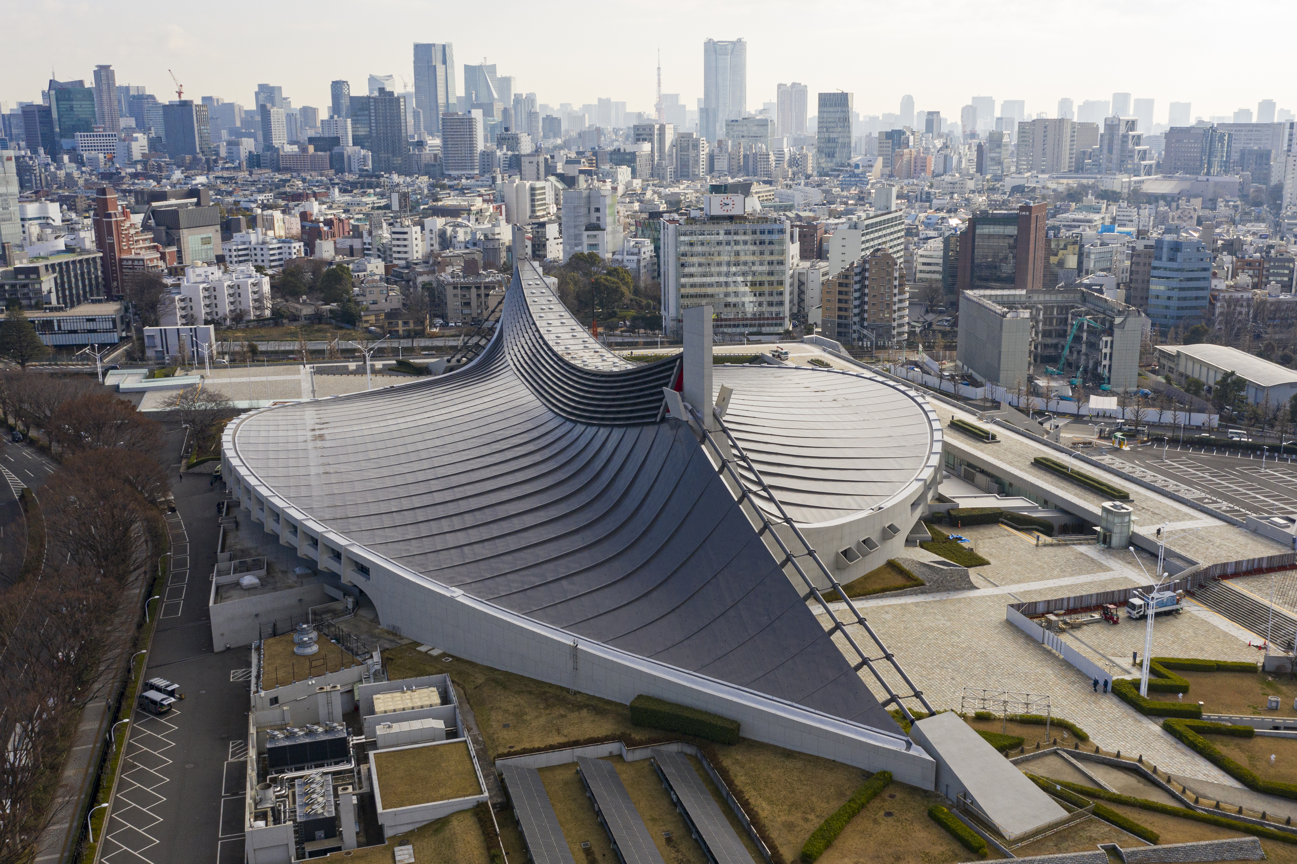
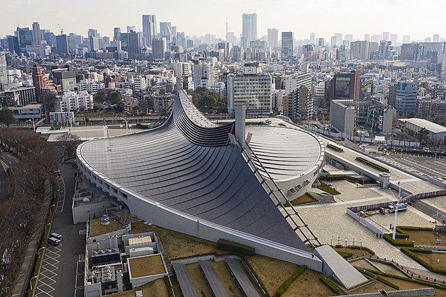
English: Aerial view of Kokuritsu Yoyogi Kyōgijō, Tokyo, Japan |
|||||||||||||||||
| Date | ||||||||||||||||||
| Source | Own work | |||||||||||||||||
| Author |
|
|||||||||||||||||
| Permission (Reusing this file) |
I published this file as author under the Creative Commons License CC-by-SA-3.0.. This means that a ‘free use outside Wikimedia’s projects’ is only possible under the following conditions:
I would be very grateful if you could send me a specimen copy of the photo/map or the details of the website where the photo/map will be used. Basically, all my photos and maps can be licensed under the conditions of the Mittelstandsgemeinschaft Foto-Marketing (MFM). Please send an email to lizenz AT arne-mueseler.de if you
Arne Müseler / www.arne-mueseler.com, the copyright holder of this work, hereby publishes it under the following license: This file is licensed under the Creative Commons Attribution-Share Alike 3.0 Germany license. Attribution: Arne Müseler / www.arne-mueseler.com
 |
|||||||||||||||||

| Camera location | | View this and other nearby images on: OpenStreetMap |
|---|

|
This image has been assessed under the valued image criteria and is considered the most valued image on Commons within the scope: Aerial view of Yoyogi National Gymnasium. You can see its nomination here. |
File history
Click on a date/time to view the file as it appeared at that time.
| Date/Time | Thumbnail | Dimensions | User | Comment | |
|---|---|---|---|---|---|
| current | 15:29, 15 January 2020 | | 4,412 × 2,941 (8.81 MB) | Arne Müseler | {{Information |description={{en|1=Aerial view of Kokuritsu Yoyogi Kyōgijō, Tokyo, Japan}} |source={{own}} |Author={{User:Arne mueseler/Autor}} |Permission={{Template:ArneMueselerCredit}} |other_versions= }} {{Location|35.667669|139.700174}} Category:Kokuritsu Yoyogi Kyōgijō Category:Japan - Photographs by Arne Müseler |
File usage
- 1964 Summer Olympics
- 2020 Summer Olympics
- 2023 FIVB Volleyball Men's Olympic Qualification Tournaments
- 2023 FIVB Volleyball Women's Olympic Qualification Tournaments
- Architecture of Tokyo
- Expressionist architecture
- Japanese architecture
- Kenzō Tange
- List of Olympic venues in swimming
- Miss International 2023
- Modern architecture
- Shibuya
- Suspended structure
- Swimming at the 1964 Summer Olympics
- The Yellow Monkey
- Tokyo
- Yoyogi National Gymnasium
- User:Triila73/sandbox/What should Miss International 2023 really look like?
Global file usage
The following other wikis use this file:
- Usage on ar.wikipedia.org
- Usage on bg.wikipedia.org
- Usage on ca.wikipedia.org
- Usage on cs.wikipedia.org
- Usage on da.wikipedia.org
- Usage on de.wikipedia.org
- Usage on de.wikivoyage.org
- Usage on eo.wikipedia.org
- Usage on es.wikipedia.org
- Usage on eu.wikipedia.org
- Usage on fa.wikipedia.org
- Usage on fy.wikipedia.org
- Usage on gl.wikipedia.org
- Usage on he.wikipedia.org
- Usage on hy.wikipedia.org
- Usage on id.wikipedia.org
- Usage on incubator.wikimedia.org
- Usage on it.wikipedia.org
- Usage on ja.wikipedia.org
- Usage on ko.wikipedia.org
- Usage on ku.wikipedia.org
- Usage on nn.wikipedia.org
- Usage on no.wikipedia.org
- Usage on pl.wikipedia.org
- Usage on pt.wikipedia.org
- Usage on ro.wikipedia.org
- Usage on ru.wikipedia.org
View more global usage of this file.