
File:COVID-19 Outbreak Cases in Iceland.svg

Size of this PNG preview of this SVG file: 799 × 560 pixels. Other resolutions: 320 × 224 pixels | 640 × 449 pixels | 1,024 × 718 pixels | 1,280 × 897 pixels | 2,560 × 1,794 pixels.
Original file (SVG file, nominally 799 × 560 pixels, file size: 78 KB)
| This is a file from the Wikimedia Commons. Information from its description page there is shown below. Commons is a freely licensed media file repository. You can help. |
Summary
| Description |
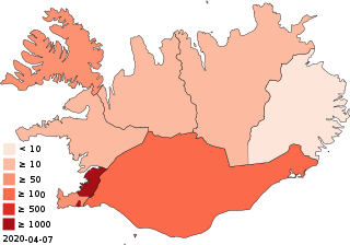
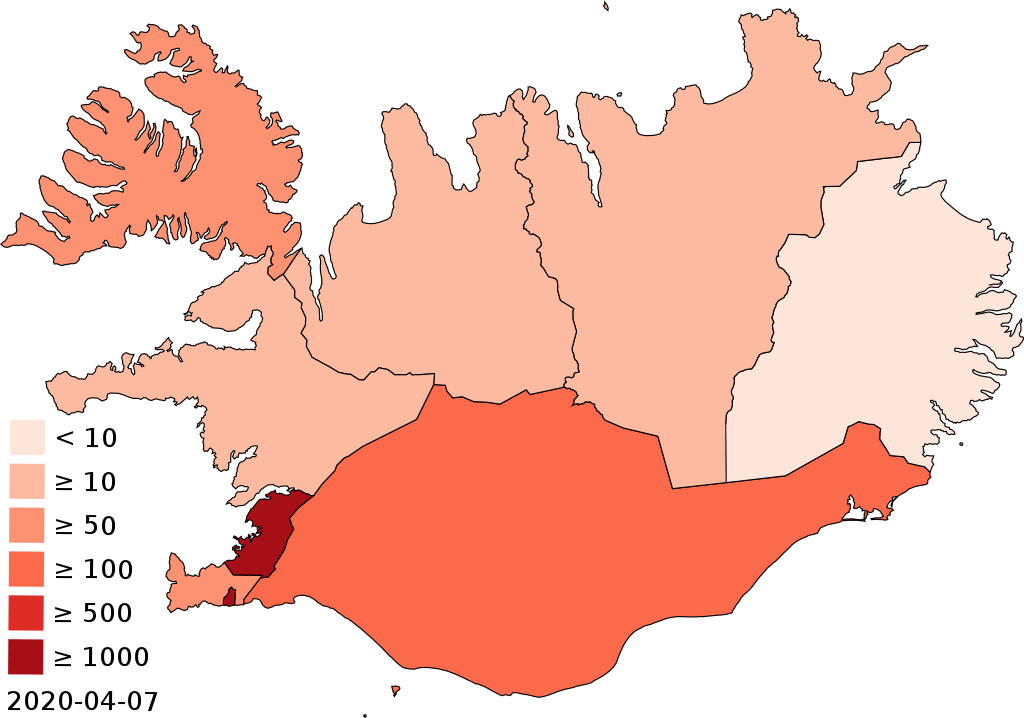
English: Map of the COVID-19 outbreak in Iceland as of 3 April 2020. Be aware that since this is a rapidly evolving situation, new cases may not be immediately represented visually. Refer to the primary article 2020 coronavirus epidemic in Iceland or the Icelandic Civil Protection Agency for most recent reported case information. See also File:COVID-19 Cases in Iceland per capita.svg for the same information on a per capita basis. |
| Date | |
| Source |
|
| Author | HueMan1 |
Licensing
I, the copyright holder of this work, hereby publish it under the following license:
This file is licensed under the Creative Commons Attribution-Share Alike 4.0 International license.
- You are free:
- to share – to copy, distribute and transmit the work
- to remix – to adapt the work
- Under the following conditions:
- attribution – You must give appropriate credit, provide a link to the license, and indicate if changes were made. You may do so in any reasonable manner, but not in any way that suggests the licensor endorses you or your use.
- share alike – If you remix, transform, or build upon the material, you must distribute your contributions under the same or compatible license as the original.
File history
Click on a date/time to view the file as it appeared at that time.
| Date/Time | Thumbnail | Dimensions | User | Comment | |
|---|---|---|---|---|---|
| current | 07:50, 9 April 2020 | | 799 × 560 (78 KB) | Bjarki S | update |
| 08:17, 4 April 2020 |  | 799 × 560 (77 KB) | Bjarki S | same colour scale as Italy map | |
| 08:04, 2 April 2020 |  | 799 × 560 (75 KB) | Bjarki S | updated with a more accurate base map | |
| 10:03, 1 April 2020 |  | 512 × 363 (61 KB) | Bjarki S | Austurland and Suðurnes moving up a category | |
| 14:38, 25 March 2020 |  | 512 × 363 (61 KB) | Bjarki S | adjusted colour scale | |
| 13:45, 25 March 2020 |  | 512 × 363 (61 KB) | Bjarki S | Norðurland eystra and Norðurland vestra with 10+ cases | |
| 16:44, 24 March 2020 |  | 512 × 363 (61 KB) | Bjarki S | Austurland is now infected, the last region | |
| 11:22, 22 March 2020 |  | 512 × 363 (61 KB) | Bjarki S | adding vesturland, according to official data on covid.is | |
| 13:10, 21 March 2020 |  | 512 × 363 (61 KB) | Bjarki S | Westfjords added according to official data | |
| 14:37, 20 March 2020 |  | 512 × 363 (61 KB) | Bjarki S | updated with a scale indicated number of cases |
File usage
The following pages on the English Wikipedia use this file (pages on other projects are not listed):
Global file usage
The following other wikis use this file:
- Usage on ar.wikipedia.org
- Usage on ca.wikipedia.org
- Usage on fa.wikipedia.org
- Usage on fr.wikipedia.org
- Usage on he.wikipedia.org
- Usage on id.wikipedia.org
- Usage on is.wikipedia.org
- Usage on it.wikipedia.org
- Usage on ko.wikipedia.org
- Usage on lv.wikipedia.org
- Usage on ms.wikipedia.org
- Usage on ru.wikipedia.org
- Usage on ru.wikinews.org
- Usage on simple.wikipedia.org
- Usage on su.wikipedia.org
- Usage on uk.wikipedia.org
- Usage on vi.wikipedia.org
- Usage on www.wikidata.org
- Usage on zh-yue.wikipedia.org