Crimean Mountain karst
| Crimean Mountain karst | |
|---|---|
IUCN category IV (habitat/species management area) | |
 A waterfall in the Crimean Mountain karst | |
| Nearest city | Generalske |
| Coordinates | 44°50′54″N 34°32′9″E / 44.84833°N 34.53583°E |
| Area | 4,316 ha (43.16 km2) |
| Established | 13 February 1989 |
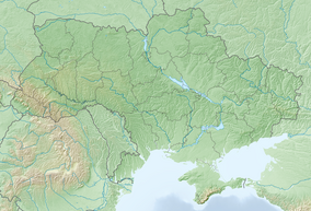
The Crimean Mountain karst (Crimean Tatar: Qırımnıñ dağ karstı; Ukrainian: Гірський карст Криму, romanized: Hirskyi karst Krymu; Russian: Горный карст Крыма, romanized: Gorny karst Kryma) is a karst and regional nature reserve (zakaznik) in Crimea, a region internationally recognised as part of Ukraine but currently under occupation by Russia since 2014. It is a part of the larger Qarabiy yayla mountain range, making up the central part of the range. The area was first described by Alexander Kruber in 1915. In 1989 the Crimean Mountain karst was recognised as a regional nature reserve.
Description[edit]
In 1915 Alexander Kruber first described the karst of the mountains.[1] The Crimean Mountain karst was declared a nature reserve in 1989. Comprising central Qarabiy yayla, the Crimean Mountain karst includes more than 4,000 sinkholes and 209 caves, among them the Soldier cave, the deepest in Crimea. Additionally, the top of the karst is home to beech and pine forests, as well as meadows and areas dominated by Cerastium biebersteinii.[2] The area has more than 1000 natural karst cavities. Minerals found in the cavities include: calcite, gypsum, goethite, aragonite, illite, quartz, kaolinite and pyrolusite.[3]
The main part of the Crimean Mountains is made up of Jurassic limestone formations 50 m (160 ft) to 1,300 m (4,300 ft) in depth. The ridge is 600 m (2,000 ft) above the Crimea southern coast. There are thousands of karst sinks with some karst fissures 100 m (330 ft) long and 50 m (160 ft) deep.[1]
Status[edit]
The Crimean Mountain karst was recognised as a regional nature preserve by the Ukrainian SSR on 13 February 1989, alongside several other areas throughout Ukraine. This designation remained in place following the Declaration of Independence of Ukraine.[4]
Since the annexation of Crimea by the Russian Federation, the Crimean Mountain karst has been recognised as a State Geographical Nature Reserve of Regional Importance (Russian: Государственный природный заказник регионального значения, romanized: Gosudarstvennyi prirodnyi zakaznik regionalnogo znacheniya), equivalent to the Ukrainian title of regional nature reserve.[5]
References[edit]
- ^ a b Gunn, John (2003). Encyclopedia of Caves and Karst Science (1st ed.). England: Routledge. p. 518. ISBN 9781135455088. Archived from the original on 4 March 2023. Retrieved 13 February 2023.
- ^ Yena, V. H.; Yena, O. V. "Гірський карст Криму" [Crimean Mountain karst]. Encyclopedia of Modern Ukraine (in Ukrainian). Archived from the original on 13 February 2023. Retrieved 13 February 2023.
- ^ Votyakov, Sergei; Kiseleva, Daria (2020). Minerals: Structure, Properties, Methods of Investigation: 9th Geoscience Conference for Young Scientists, Ekaterinburg, Russia, February 5–8, 2018 ... in Earth and Environmental Sciences). New York City: Springer Publishing. p. 129. ISBN 978-3030009243. Archived from the original on 4 March 2023. Retrieved 13 February 2023.
- ^ "Про створення заказників, ботанічного саду та дендрологічного парку загальнодержавного значення" [On creation of nature reserves, a botanical garden, and a dendrological park of national importance]. Verkhovna Rada (in Ukrainian). 13 February 1989. Archived from the original on 13 February 2023. Retrieved 13 February 2023.
- ^ Miroshnychenko, Vlad (16 March 2020). "Природа Криму під окупацією. Частина 1" [Crimean nature under occupation: Part 1]. Black Sea News (in Ukrainian). Archived from the original on 13 February 2023. Retrieved 13 February 2023.


